Watching Grass Grow … From Space
Knowing when your fields are an optimal length for grazing is crucial for grassland farmers or ranchers. Satellites may be the best way to get that information.
Watching Grass Grow … From Space
Knowing when your fields are an optimal length for grazing is crucial for grassland farmers or ranchers. Satellites may be the best way to get that information.
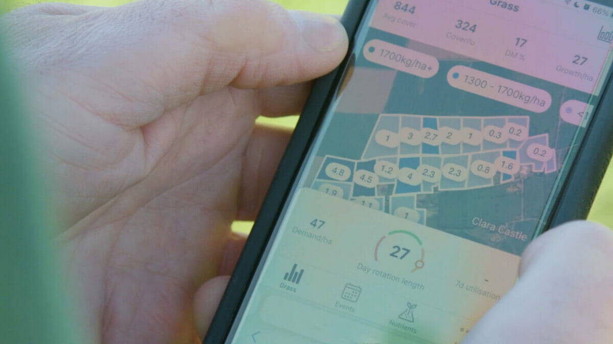
A farmer uses the GrassMax app in the field, checking grass growth against demand from livestock.courtesy Origin Digital.
There’s a sweet spot of the grass growing stage you want to hit in terms of timing for grazing. Soon, farmers will be able to find that crucial time with help from satellites.
A new in-app remote-sensing technology launching later this year in Ireland will allow farmers to accurately measure the height of grass in their grazing paddocks from space. Satellite data will assist Origin Digital’s service GrassMax in providing users precise information about their fields, which program founders hope will lead to increased productivity and profitability for farmers.
The sweet spot for grass is when it has sprouted three offshoots, called the three-leaf stage, says Kieran Holden, grassland digital specialist at Origin Enterprises. This optimizes fuel for the animal, which influences how much meat they produce, and has a huge impact on farmers’ profitability.
“That’s when there’s an optimum amount of energy in the grass; it’s when there’s an optimum amount of fiber in the grass and there’s an optimum amount of protein in the grass,” says Holden.
Measuring grass has become a common tool for efficient grazing rotation in places such as Ireland, where grass-fed dairy is a big industry. Strategies for measuring grass range from the cut-and-weigh method to using plate meters to walking the field and taking stock of the grass by eye. These methods help calculate the dry matter available, which gives farmers an idea of how much feed is in the field.
Still, all of these methods take time. Walking your fields takes a few hours each time you do it, says Holden, and it can be inconsistent. Holden says this technology enables more efficient use of resources, serving to be more economically and environmentally sustainable.
In collaboration with Aspia Space, Origin Digital is using synthetic-aperture radar (SAR) satellite data to measure grass. SAR is a remote sensing tool that creates an image using radio waves. For grass-measuring purposes, this is preferable over camera imaging because it can overcome visual obstacles presented by weather.
“Lots of grass needs lots of rain, and where you have lots of rain, you have lots of clouds, and where you have lots of clouds, you have an issue with optical sensors,” says Holden. The satellite data will work in conjunction with other in-app technology such as weather-based growth models to create an accurate picture of grass in a farmer’s paddock.
Expanded access to satellite data means that a lot of industries are finding creative uses for it—especially when it comes to land management. Data collected by satellites are now used to map ghost forests and understand changes in sea-level rise. The National Park Service even uses satellite imagery to monitor landscape changes in some of its parks. Agriculture is no exception.
Last year, Planet and Organic Valley completed a pilot program using satellite imagery to evaluate pasture health in service of regenerative rotational grazing. The US Department of Agriculture recently funded research using satellite data to evaluate climate smart adaptations in agriculture, and the US Senate is considering a bill that would make precision agriculture, a practice involving technology such as satellites, available to more rural farmers. Agriculture technology has grown leaps and bounds over the last generation, says Holden.
“We have a small farm at home as well. My father initially started off plowing with a horse, and here we are talking about using satellite data to measure grass at home. It’s amazing what happens in a short space of time.”
read more
Welcome to the Next Generation of Agricultural Drones.
Follow us
Republish!
![]()
Republish our articles for free, online or in print, under a Creative Commons license.

This work is licensed under a Creative Commons Attribution-NoDerivatives 4.0 International License.
Want to republish a Modern Farmer story?
We are happy for Modern Farmer stories to be shared, and encourage you to republish our articles for your audience. When doing so, we ask that you follow these guidelines:
Please credit us and our writers
For the author byline, please use “Author Name, Modern Farmer.” At the top of our stories, if on the web, please include this text and link: “This story was originally published by Modern Farmer.”
Please make sure to include a link back to either our home page or the article URL.
At the bottom of the story, please include the following text:
“Modern Farmer is a nonprofit initiative dedicated to raising awareness and catalyzing action at the intersection of food, agriculture, and society. Read more at <link>Modern Farmer</link>.”
Use our widget
We’d like to be able to track our stories, so we ask that if you republish our content, you do so using our widget (located on the left hand side of the article). The HTML code has a built-in tracker that tells us the data and domain where the story was published, as well as view counts.
Check the image requirements
It’s your responsibility to confirm you're licensed to republish images in our articles. Some images, such as those from commercial providers, don't allow their images to be republished without permission or payment. Copyright terms are generally listed in the image caption and attribution. You are welcome to omit our images or substitute with your own. Charts and interactive graphics follow the same rules.
Don’t change too much. Or, ask us first.
Articles must be republished in their entirety. It’s okay to change references to time (“today” to “yesterday”) or location (“Iowa City, IA” to “here”). But please keep everything else the same.
If you feel strongly that a more material edit needs to be made, get in touch with us at [email protected]. We’re happy to discuss it with the original author, but we must have prior approval for changes before publication.
Special cases
Extracts. You may run the first few lines or paragraphs of the article and then say: “Read the full article at Modern Farmer” with a link back to the original article.
Quotes. You may quote authors provided you include a link back to the article URL.
Translations. These require writer approval. To inquire about translation of a Modern Farmer article, contact us at [email protected]
Signed consent / copyright release forms. These are not required, provided you are following these guidelines.
Print. Articles can be republished in print under these same rules, with the exception that you do not need to include the links.
Tag us
When sharing the story on social media, please tag us using the following: - Twitter (@ModFarm) - Facebook (@ModernFarmerMedia) - Instagram (@modfarm)
Use our content respectfully
Modern Farmer is a nonprofit and as such we share our content for free and in good faith in order to reach new audiences. Respectfully,
No selling ads against our stories. It’s okay to put our stories on pages with ads.
Don’t republish our material wholesale, or automatically; you need to select stories to be republished individually.
You have no rights to sell, license, syndicate, or otherwise represent yourself as the authorized owner of our material to any third parties. This means that you cannot actively publish or submit our work for syndication to third party platforms or apps like Apple News or Google News. We understand that publishers cannot fully control when certain third parties automatically summarize or crawl content from publishers’ own sites.
Keep in touch
We want to hear from you if you love Modern Farmer content, have a collaboration idea, or anything else to share. As a nonprofit outlet, we work in service of our community and are always open to comments, feedback, and ideas. Contact us at [email protected].by Lena Beck, Modern Farmer
July 31, 2023
Modern Farmer Weekly
Solutions Hub
Innovations, ideas and inspiration. Actionable solutions for a resilient food system.
ExploreExplore other topics
Share With Us
We want to hear from Modern Farmer readers who have thoughtful commentary, actionable solutions, or helpful ideas to share.
SubmitNecessary cookies are absolutely essential for the website to function properly. This category only includes cookies that ensures basic functionalities and security features of the website. These cookies do not store any personal information.
Any cookies that may not be particularly necessary for the website to function and are used specifically to collect user personal data via analytics, ads, other embedded contents are termed as non-necessary cookies.
This is preferable to using a camera for measuring grass since it can get beyond weather-related visual obstructions. To accurately depict the grass in a farmer’s field, the satellite data will be combined with technology from other applications, like weather-based growth models.
This innovative approach is a game-changer for farmers, providing accurate, efficient, and sustainable management of grasslands. The use of satellite imagery, especially with synthetic-aperture radar (SAR), is ingenious as it overcomes the limitations of visual assessments under varying weather conditions. The broader implications for land management and agricultural practices are immense, showing how far we’ve come from traditional methods to high-tech solutions that can significantly impact productivity and environmental sustainability.