An Ancestral River Runs Through It
A rural Montana county has found a unique and forward-thinking way to share its groundwater.
An Ancestral River Runs Through It
A rural Montana county has found a unique and forward-thinking way to share its groundwater.

by Keely Larson
Jeff Wivholm isn’t partial to mountains. He likes to be able to see the weather rolling in, something remarkably possible in the northeastern corner of Montana.
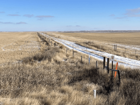
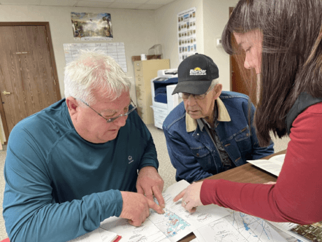
On a cold January morning, Wivholm drives the dirt roads between farms in Sheridan County, where he’s lived for all his 63 years, with practiced ease, pointing out different plots of land by who owns them. And if he doesn’t know the family name, Amy Yoder with the Sheridan County Conservation District or Brooke Johns with the Medicine Lake National Wildlife Refuge — both sitting in the backseat of his truck — can supply it.
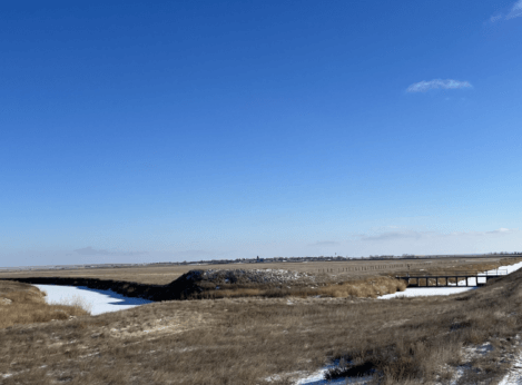
If you look to the right there, Wivholm says, you can see the valley created by the aquifer. Maybe he can, his eyes accustomed to seeing dips and crevasses in, to an unfamiliar eye, a starkly flat landscape. He laughs and says it takes some getting used to.
That aquifer isn’t unique in Montana. There are 12 principal aquifers running like underground rivers throughout the state. But the way Sheridan County uses the water is.
Montana is in relatively good shape as far as its groundwater supply goes, something uncommon across much of the country, geologist John LaFave with the Montana Bureau of Mines and Geology says. State politicians initiated a groundwater study over 30 years ago after years of intense drought and fires and a lack of data.
But Sheridan County was ahead of the game: The county’s conservation district started studying its groundwater in 1978, before state monitoring began.
In 1996, the district was granted a water reservation, or water allocated for future uses, from the state, which meant it could take a certain share of water from the Clear Lake Aquifer. Because of all the data it gathered through studying its groundwater, the district developed a unique way of using and distributing that water.
What’s unusual is how intentional the collaboration was and how extensive the groundwater monitoring was and continues to be. The district does this by working with farmers, tribes and the US Fish & Wildlife Service (USFWS) to ensure water can be used by those who need it — those who would be most affected by any degradation to the water — without negatively impacting the environment.
And it’s worked. The conservation district has been using its geologically special aquifer — a gift granted to this area by the last Ice Age — to irrigate crops, provide jobs for the region and keep agriculture dollars within the community for almost 30 years while fielding few complaints.
“To me, this represents the way groundwater development should occur,” LaFave says.
Sheridan County is extremely rural, home to about 3,500 people across its 1,706 square miles. Agriculture is a big economic driver. Bird hunting is an attraction for locals and visitors. The Medicine Lake National Wildlife Refuge, located in both Sheridan and Roosevelt Counties and managed by the USFWS, is home to many migratory bird species. It’s the largest pelican breeding ground in Montana and the third-largest in the country.
This early January morning, it’s about five degrees, but there isn’t a lot of snow on the ground. Over coffee and breakfast in Plentywood — the county seat — Yoder and Wivholm say this winter has been warmer and drier than usual.
Dry weather is not uncommon here. Droughts in the 1930s and ’80s were particularly rough. Also in the ’80s, irrigation technology was becoming more common and efficient, Wivholm says, and people began to pay more attention to the possibility of an aquifer as a way to ensure water would be available for irrigation.
“There are several nicknames for much of this property, but it was basically ‘poverty flats,’” Jon Reiten, hydrogeologist with the Montana Bureau of Mines and Geology, says. The soil is sandy, gravelly and drought-prone. Not great for dry-land farming.
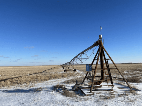
Marlowe Onstead was the first farmer in Sheridan County to use the aquifer for his pivot irrigation in 1976.
“Couldn’t raise the crop on it before,” Onstead says. After irrigation, he was able to grow alfalfa.
According to Reiten, the aquifer ranges from a mile to six miles wide and two to three hundred feet deep. The ancestral Missouri River channel, discovered in Sheridan County in 1983 as monitoring began, flowed north into Canada and east into Hudson Bay. That channel was dammed by glaciers in the last Ice Age and left behind a reservoir that was buried as glaciers melted, creating the Clear Lake Aquifer. Since the materials left behind were coarse and varied, water could move easily and be stored in great depths. A downside is that these glacial aquifers can take a long time to refill.
As drought dragged on in the ’80s, locals and county and state authorities set about figuring out the best way to distribute the aquifer’s water. Medicine Lake lies on top of some of the aquifer, and the Big Muddy Creek — where the Fort Peck Tribes require a minimum in-stream flow to promote ecosystem health — is at its southwestern border.
The Fort Peck Tribes and the USFWS were concerned about their respective water levels and how they’d be impacted by irrigation. Reiten says the USFWS was objecting to just about every water rights case that went to the state at the time, and all that litigation ended up in water court.
“That’s a lot to put on a producer, to have to go up against the federal government,” Reiten says.
Negotiations with the USFWS and the Fort Peck Tribes led to the formation of an advisory committee and the transfer of the water reservation on the aquifer from the state to the conservation district. (Per Montana water law, all water belongs to the state and individuals are required to get a water right to use it in a particular way — in this case, for irrigation.) Since then, Sheridan County Conservation District has had the authority to give water allocations from the Clear Lake Aquifer to producers without the producers having to appeal to the state.
The maximum amount of water that can be pulled from the aquifer is just over 15,000 acre feet total, a number set by the state’s Department of Natural Resources and Conservation. Currently, the district is using about 10,000 acre feet. Increases are allowed as long as monitoring shows the aquifer isn’t being overly impacted by irrigation.
“We were basically forced to monitor it, but it only makes good sense,” Wivholm, who has been on the conservation district board since 1994, explains. The district wouldn’t want to grant someone a right only to find out in five years that there’s not enough water.
Once a year, the committee meets to assess new water rights. The committee includes the Montana Bureau of Mines and Geology, the state Department of Natural Resources and Conservation, representatives from the Medicine Lake National Wildlife Refuge, county commissioners, a county planner, the Fort Peck Tribes and a representative with the United States Geological Survey.
If a farmer wants an irrigation pivot, they have to “pump it hard for 72 hours,” Wivholm says, to make sure there is enough water for their request, and understand how that pumping affects other wells nearby.
Data comes from Yoder’s efforts. She collects readings from data loggers placed in the ground throughout the county from April through October. For the first and last collections, she visits 201 wells and it takes her three 12-hour days to get to them all. Driving around in Wivholm’s truck, she points out some of her data loggers sticking up from the ground every few minutes.
Through monitoring, Sheridan County Conservation District and the Montana Bureau of Mines and Geology have been able to map the entire aquifer. They take note of the water levels, monitor each irrigation pivot and can see seasonal fluctuations.
“It’s kind of a hidden resource, but the amount of crops that we can get off of the poor ground that is above the aquifer is amazing,” Yoder says. She lists corn, wheat, chickpeas, lentils, canola, mustard and alfalfa.
Another farmer in the area, Rodney Smith, has been irrigating from the Clear Lake Aquifer for over 35 years and has the biggest pivot connected to the aquifer.
Smith says irrigating has been economically beneficial: His farm isn’t as dependent on the weather, and it’s taken the risk out of production. Smith Farms Incorporated produces hay for livestock and sells it to other ranchers in the area. Smith also leases land out to other farmers who grow potatoes and sugar beets.
From an aerial view, his circular pivot plots show different colors of green and brown, indicating a variety of crops grown.
Smith had an early contested pivot case with the state of Montana, before the water reservation was transferred to the conservation district, which went to the state water court.
The gist of the case was that Smith Farms wanted to change their method of irrigation and the USFWS was concerned it might impact the Medicine Lake National Wildlife Refuge. Data and monitoring done by the conservation district backed up Smith’s case.
“When you start irrigating, you wonder what is the capacity, or how much can you irrigate,” Smith says. “It’s always interesting to know what it’s doing.”
Johns, with the wildlife refuge, says the refuge has a water reservation on Medicine Lake and is allowed to keep the lake filled for the protection of migratory birds. The refuge operates dams and diversions to maintain this need. Making sure any irrigation wouldn’t draw down the level of the lake has been a goal from the beginning, Johns says, and so far, that hasn’t been an issue.
There haven’t been any other contested cases on aquifer irrigation, and many, including Smith, see this as a success in having local control over a local resource.
“Water rights are such a contentious thing,” Johns notes. “And without the data, had they not started this years ago, it would be hard to start it today and get the same momentum they did.”

The soil moisture monitoring sounds helpful to know when too much water us being used. They seem to be aware of basic environmental factors, but what about ecological factors? From a holistic management approach, how helpful would it be to encourage perennial planting around the periphery outside the pivot irrigated crop areas? Plants to increase habitat, plants to increase carbon, and other factors that improve soil moisture-holding capacity and organic matter so over the decades less water is needed and the preciously limited acre feet can be used by more people in other areas who are also improving everything for… Read more »