5 Ways Data Will Transform Global Agriculture
The G-8 International Conference on Open Data for Agriculture finished up yesterday, a two-day celebration of data transparency. High-profile speakers like Secretary of Agriculture...
The G-8 International Conference on Open Data for Agriculture finished up yesterday, a two-day celebration of data transparency. High-profile speakers like Secretary of Agriculture Tom Vilsack and Bill Gates (virtually present) were on-hand to usher in a “new, open era” in ag data.
But the event was more than empty platitudes and promise of a golden age. Conceptually, the conference was seen as a powerful response to the secrecy shrouding agriculture in China and some large agriculture companies (Cargill, ADM). And practically, attendees witnessed myriad ways that open data is reshaping global farming and food security.
Here are five great examples:
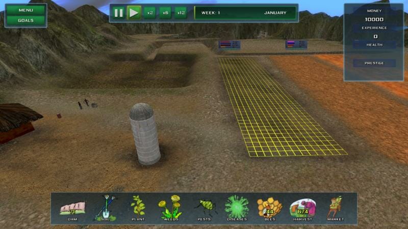
1) Simulated African Farming: “If you can’t beat this game, you’re not qualified for the job.” It’s a cheeky tagline, but Farm Defenders (pictured above) isn’t frivolous. Using actual soil, climate, botanical, and ecological data, this game simulates the travails of an African farmer: climatic devastation, blight, operating on less than $2 a day. Gameplay can be tailored to your specific region, be it lush tropics or barren desert. This educational tool is still in beta, but many international organizations want to be early adopters.
2) Mapping Water Risk: Water scarcity is on the shortlist of things we all need to worry about, now. Aqueduct may not provide easy answers, but it’s certainly helping. After three years of exhaustive data aggregation, the World Resources Institute created this database and interactive tool. It shows water quality problem areas, predictive data for floods and droughts, supply-to-demand ratios, and much more. Risk scores are given for any location, and heat maps indicate the biggest problem areas. Aqueduct has already been used in making global policy decisions.
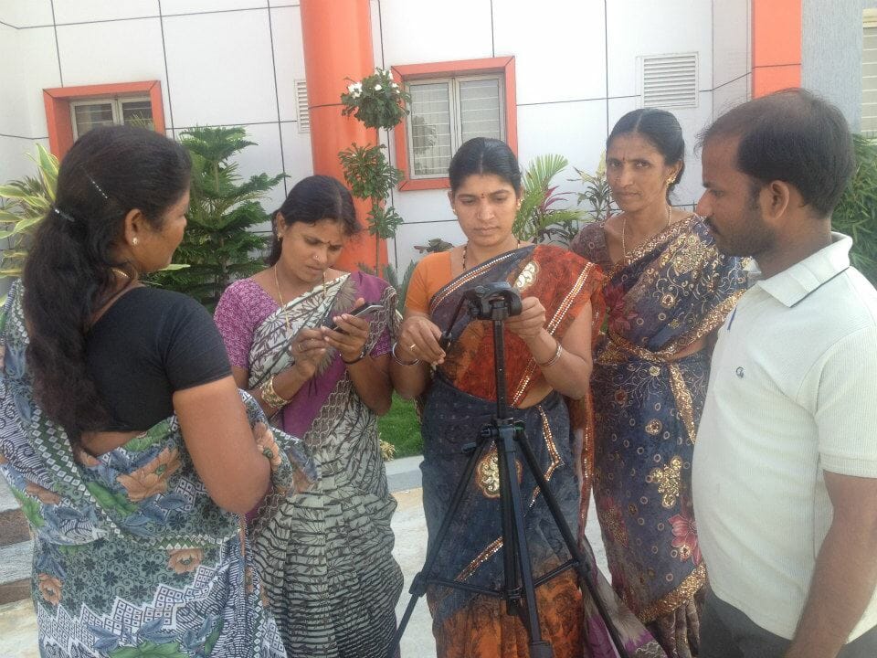
3) Farmers Teaching Farmers: Using low-cost pocket video cameras, Digital Green is compiling and sharing a massive database of first-person instructional videos from across India. Each video is 8 to 10 minutes long, made by a farmer, addressing questions like “How do you dehorn a crossbred calf?” or “How do you control disease in a tomato leaf curl?” They’ve compiled and screened videos in over 2000 villages, and they’re dreaming big – by 2015, they plan to work with a million farmers in 10000 villages.
4) What to Plant, Where: As part of a USAid Hackathon last fall, two nonprofits teamed up to revolutionize Uganda’s approach to planting. Using 28,000 geocoded soil samples provided by the Grameen Foundation, Palantir Technologies created a comprehensive soil map of Uganda. It includes pH levels, optimal places to plant top crops – maize, coffee, bananas, and soybeans – and risk areas for maggots and other pests. This app’s value will continue to increase, as other datasets are imposed on the soil info.
5) One-Stop Data Shopping: Sec. Vilsack revealed a long-planned “virtual community” at the start of the G8 conference, providing an immense storehouse of previously unreleased ag data. This government data portal aims to be approachable for small-scale farmers and policy analysts alike. Topics range from fruit and nut tree data to a foodborne illness cost calculator.