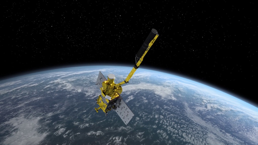
NASA’s SMAP Satellite Collects Soil Moisture Content Worldwide
In two days, it can scan the entire planet.
NASA’s SMAP Satellite Collects Soil Moisture Content Worldwide
In two days, it can scan the entire planet.
“Soil moisture is very important because it’s a leading indicator of future vegetation conditions,” says John Bolten, a hydrologist at NASA’s Goddard Space Center. The amount of moisture in the soil tells you about everything from how well plants will grow to whether a flood is likely, and is a vital part of climate and temperature measurements. And yet our global soil moisture data has in the past been spotty at best.
Launched in January 2015, SMAP – it stands for Soil Moisture Active Passive, not one of NASA’s best names – is the first NASA satellite to specifically measure global soil moisture. It does so via a two-pronged approach, one that’s sort of like a camera, one more like radar, to measure microwave emissions from the land’s surface. Those microwave emissions, it turns out, are highly correlated with the water content in the first five centimeters of the soil – so highly correlated that SMAP is accurate to within four percent. For now, it measures in blocks of 25 square kilometers, but NASA is figuring out ways to get smaller and more detailed.
Soil moisture content is an incredibly valuable bit of data. It can be used to measure crop stress and the likely quality of crops, to save water, to predict floods and droughts and landslides, be used to measure the amount of water (and thus pesticide) runoff, etc. etc. SMAP, for the first time, enables outrageous amounts of accurate information to be gathered quickly; Bolten says that the satellite can map the entire planet in two or three days.
This data is especially valuable in food-insecure countries or regions. Chances are, if just growing enough food to eat is a struggle, a country or region may not have enough money to invest in soil moisture sensors. But SMAP’s data is all public, and Bolten says NASA’s applied science group is involved in helping out anyone who needs assistance understanding the data. (It’s also on Google Earth.)
The first round of data from SMAP became available a few months ago, but the USDA just this week announced that it will be incorporating SMAP’s data into its Crop Explorer tool. Crop Explorer is the USDA’s massive tool that shows real-time information on global crops; it’s used by agriculture analysts to predict everything from corn prices to whether there will be a flood halfway around the world. SMAP’s soil moisture data is a huge piece of the puzzle.
Follow us
Republish!

Republish our articles for free, online or in print, under a Creative Commons license.

This work is licensed under a Creative Commons Attribution-NoDerivatives 4.0 International License.
Want to republish a Modern Farmer story?
We are happy for Modern Farmer stories to be shared, and encourage you to republish our articles for your audience. When doing so, we ask that you follow these guidelines:
Please credit us and our writers
For the author byline, please use “Author Name, Modern Farmer.” At the top of our stories, if on the web, please include this text and link: “This story was originally published by Modern Farmer.”
Please make sure to include a link back to either our home page or the article URL.
At the bottom of the story, please include the following text:
“Modern Farmer is a nonprofit initiative dedicated to raising awareness and catalyzing action at the intersection of food, agriculture, and society. Read more at <link>Modern Farmer</link>.”
Use our widget
We’d like to be able to track our stories, so we ask that if you republish our content, you do so using our widget (located on the left hand side of the article). The HTML code has a built-in tracker that tells us the data and domain where the story was published, as well as view counts.
Check the image requirements
It’s your responsibility to confirm you're licensed to republish images in our articles. Some images, such as those from commercial providers, don't allow their images to be republished without permission or payment. Copyright terms are generally listed in the image caption and attribution. You are welcome to omit our images or substitute with your own. Charts and interactive graphics follow the same rules.
Don’t change too much. Or, ask us first.
Articles must be republished in their entirety. It’s okay to change references to time (“today” to “yesterday”) or location (“Iowa City, IA” to “here”). But please keep everything else the same.
If you feel strongly that a more material edit needs to be made, get in touch with us at [email protected]. We’re happy to discuss it with the original author, but we must have prior approval for changes before publication.
Special cases
Extracts. You may run the first few lines or paragraphs of the article and then say: “Read the full article at Modern Farmer” with a link back to the original article.
Quotes. You may quote authors provided you include a link back to the article URL.
Translations. These require writer approval. To inquire about translation of a Modern Farmer article, contact us at [email protected]
Signed consent / copyright release forms. These are not required, provided you are following these guidelines.
Print. Articles can be republished in print under these same rules, with the exception that you do not need to include the links.
Tag us
When sharing the story on social media, please tag us using the following: - Twitter (@ModFarm) - Facebook (@ModernFarmerMedia) - Instagram (@modfarm)
Use our content respectfully
Modern Farmer is a nonprofit and as such we share our content for free and in good faith in order to reach new audiences. Respectfully,
No selling ads against our stories. It’s okay to put our stories on pages with ads.
Don’t republish our material wholesale, or automatically; you need to select stories to be republished individually.
You have no rights to sell, license, syndicate, or otherwise represent yourself as the authorized owner of our material to any third parties. This means that you cannot actively publish or submit our work for syndication to third party platforms or apps like Apple News or Google News. We understand that publishers cannot fully control when certain third parties automatically summarize or crawl content from publishers’ own sites.
Keep in touch
We want to hear from you if you love Modern Farmer content, have a collaboration idea, or anything else to share. As a nonprofit outlet, we work in service of our community and are always open to comments, feedback, and ideas. Contact us at [email protected].by Dan Nosowitz, Modern Farmer
June 11, 2018
Modern Farmer Weekly
Solutions Hub
Innovations, ideas and inspiration. Actionable solutions for a resilient food system.
ExploreShare With Us
We want to hear from Modern Farmer readers who have thoughtful commentary, actionable solutions, or helpful ideas to share.
SubmitNecessary cookies are absolutely essential for the website to function properly. This category only includes cookies that ensures basic functionalities and security features of the website. These cookies do not store any personal information.
Any cookies that may not be particularly necessary for the website to function and are used specifically to collect user personal data via analytics, ads, other embedded contents are termed as non-necessary cookies.